Mangatawhiri Dam - Hunua
70 km from Auckland is the Mangatawhiri Dam. The map below shows the route from the Papakura - Hunua Rd to the dam.

Google Earth provides a birds eye view if the route shown on the map.


Arriving at the lower carpark next to the camping ground there was an information board that detailed walking tracks and points of interest.

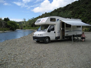
The overnight parking for motorhomes (must have selfcontainment certificate) was on the other side of the carpark next to a grove of Kaihikatea trees. $5 per night per adult, maximum stay 2 nights.


There's a road along the top of the dam along which you can walk. Walking on the grass face is not permitted.

The camping ground can be seen in the distance.

The upper carpark is at the beginning of the dam top road .

The dam is reputed to supply 19% of Aucklands water needs. At this time at the end of the wharf the water measured some 90ft deep.

At the far end from the carpark is the spill way.

Enjoyed by others.

The spillway exits to the stream that was shown earlier on in the pics.

The dam is well worth a visit and would appear to be the most popular of the four in the area.


No comments:
Post a Comment