Wednesday, May 26, 2010

South Island - Our Intrepid Journey Day 198 – 219 02 - 24 May 2010

 From Lake Dunstan (see pics previous blog) on our way back to Nelson for the winter.

At many of the locations where pics have been taken from there were geocaches.  For interest these have been identified with GC. If you want to know about geocaching check out www.geocaching.com   

We are now wintering over in Nelson for possibly three months until the end of August.  During this time this blog will semi hibernate with most of the content being limited to Tasman and Golden Bay and any geocaches we find in the area.  This blog is best viewed in conjunction with Raewyn's email episode that corresponds with the same days and dates. 

(NOTE:  If you have any trouble with pics ‘fully showing let me know barrieb@arkon.co.nz   Also if you double click on the pic it should show completely.)

Lake DunstanThe following few pics were taken early morning at our free camp at lake Dunstan.  Out first frost. 
 

Lake Dunstan The morning sun tries to to break through the morning mist.

Chatto Creek.  Historic post office that’s still in use. GC

Ophir.  One lane bridge on the way to the historic town of Ophir. GC


St Bathans.  The historic haunted Vulcan Hotel.

St Bathans.  The following are some pics taken on our walk around the Blue Lake.

St Bathans.  It's just big enough for some limited water skiing.

St Bathans.  All around the lake there is evidence of the early gold mining days.

St Bathans.  The lake is really blue.

St Bathans.  The shoreline in mostly barren.

St Bathans.  Except for the south western end.

St Bathans.  Most of the landscape is quite barren.

St Bathans.  Could be mistaken for Aku Aku maybe.

On the road again.  Road through the Maniatoto heading to Wedderburn

NasebySpruce forest in autumn. GC

Naseby.  The home of curling. GC

Naseby.  No they have an Olympic indoor curling rink now so there's little use for this one.

Naseby.  The use of the outdoor swimming pool in the Black Forest must be somewhat limited.  It is a big hole dug in the ground with concrete poured in in parts. GC

NasebyWhat we would do to get to a geocache. GC

Naseby.  There was a geocache out by Coal Pit Dam – on the far side. GC

Mosgiel.  Early morning training at the Wingatui Race Course.

Mosgiel.  Our camp for more than ten days.

Mosgiel.  After a long walk through the Flagstaff forest in the hills behind Mosgiel to find a geocache the path ended at this historic water wheel.  Yes it was a bit dark in the forest. GC


Aramoana.  A memorial of a past tragedy that will long be remembered. GC

Aramoana.  Protected wetlands looking back to Port Chalmers.  Note the container ship at the port. GC

Port Chamlers.  Same container ship seen from Aramoana now on its way. GC

Port Chalmers.  With the Pilot boat on its way for support.  GC

Waikouaiti.  Throughout our travels we have come across a number of grandstands of all sizes that are almost now derelict.  GC

Waikouaiti.  Boot hill looking for another geocache. GC

Waikouaiti.  Many of the trees that leaked sap were covered in butterflies and some wasps.

Waikouaiti.  A close up of the specie of butterfly that was in hundreds in the area.

Waikouaiti.  A little further north is a wetland called Flag Swamp and a geocache.  Where ever we went we were accompanied by Madeline who enjoyed the wild (scrumped) apples that we gave her.  GC

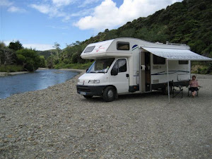
Half Way (almost).  Yes there was a geocache here.  It was worth a stop for a cuppa. GC

Temuka.  The symmetry of a pastoral scene.  GC

Temuka.  Is famous for it’s pottery.  Maybe even these on the old courthouse.

Temuka.  There was a geocache in the garden of trees of the world.  Autumn colour show off.  GC

Kaikoura.  A typical beach scene.  We stopped for lunch and a geocache. GC

Blenheim.  An old cottage.  Historic Cob Cottage is well worth a visit.  GC

Blenheim.  A modern cottage! GC

Blenheim.  A few more pics of autumn colours. GC

Blenheim.  The vineyards are sure a picture this time of year.


Lake Argyle.  Just added for a brag.  1.5 and 1.3kg brown trout caught on my own tied flies prepared for smoking – yum! GC

Tophouse.  On the road back to Nelson.  Early transport means. GC


Well that's it for this lot - next time then.........................


Sunday, May 2, 2010

South Island - Our Intrepid Journey Day 181 – 197 16 April – 02 May 2010

From Invercargill to Lake Dunstan and a few places in between.
  
The following are some pics of some of location we have been to over these few days.  This blog is best viewed in conjunction with Raewyn's email episode that corresponds with the same days and dates.
 Invercargill.  Bottoms up in Queens Park.
 Invercargill.  The weather in Invercargill wasn’t much good but it was nice and warm in the velodrome.
 Gore.  Yes the trout are big in the Mataura River.
 Gore.  Do you remember Creamota?
 Gore.  You’ve got to scrump where you can!
 Waipahi.  One of the most photographed road signs in New Zealand, you can see why.
 Waipahi.  Yes more railway tracks.
Wangamaloa.  We free parked on the coast just outside of Balclutha.
LawrenceWe enjoyed one of the walks through historic Gabriels Gully.
LawrenceAutumn is now well with us.
 LawrencePatterns and colours everywhere.
 LawrenceMust admit the rabbits are well more advanced than ‘up north’.
Roxburgh.  Pinders Pond provided a real nice free camp site.
 Roxburgh.  Although the trout refused to play.
 Roxburgh.  The bridge over the Clutha made a nice picture.
Roxburgh.  There was a lot of water coming down the Clutha.
 
Roxburgh.  The apple season is now over.
 Roxburgh.  Roxburgh dam and and lake.
Roxburgh.  The rocks in the area had interesting sediment patterns.
Alexandra.  The Clutha river poses for more pics.
Alexandra.  It’s called the Swinging Bridge, on it was a geocache.  We found it, walked it and photographed it.
Alexandra.  Old bridges over the Clutha are popular for photographers.
Alexandra.  Butchers Dam, a free camp site, invites anglers.
 Alexandra.  Butchers Dam. Yes I can and do catch trout.
 Alexandra.  Locals keep an eye on us northerners.
Alexandra.  For some the local pond is the safest place to be with duck season is only a few days away!
 Alexandra.  Every bridge over the Clutha is different.
 ClydeWhat a picture the cemetery outside of Clyde makes.
 ClydeJust outside Clyde heading to find a geocache on the Ferguson River we passed this row of Popular trees.
 Lake DunstanThe following few pics were taken early morning at our free camp at lake Dunstan.  

Lake Dunstan.  Out first frost.  Yes did catch trout here.
Lake Dunstan The morning sun tries to to break through the morning mist.