21 October 2010 – 11 November 2010
This blog is best viewed in conjunction with Raewyn's email episode that corresponds with the same days and dates. If you don’t get that email let us know. There are a great deal more pics taken at places mentioned and places in between. At some of the locations where pics have been taken from there were geocaches. For interest these have been identified with ‘GC’. If you want to know about geocaching check out www.geocaching.com .
(NOTE: If you have any trouble with pics ‘fully showing let me know barrieb@arkon.co.nz Also if you double click on the pic it should show completely.)
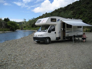
This part of the journey starts at Lake Argyle

From a previous visit you can see the remnants of winter.

This trip the lake was quiet and calm. One of our favourite trout fishing destinations. This pic was taken from the campsite looking northward.

Unfortunately we were the last ones in New Zealand

From Lake Argyle it was off to St Arnaud and Lake Rotoiti


Like all mother, it’s kids off for bath time.

There are some really nice walks around Lake Rotoiti

The journey towards Westport continues along the side of the Buller River

One stop on the way, a short walk from the road, is at the only falls/rapids on the Buller River
Ariki Falls. Doesn’t really much at this time. gc

Not far from Ariki Falls

A walk through the bush in the subdued light
gc

Brings you to the Lyell old cemetery in the bush.


Arriving at Westport
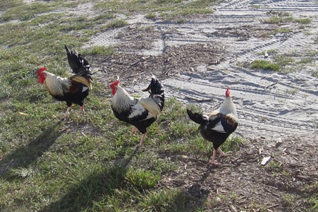
Which suited the locals looking for a few scraps.

A walk around town soon reminds you of its coal mining heritage. gc


And the size of some of the machinery used.

Many days the tour doesn’t run due to the altitude where mist and cloud becomes a problem.


A larger sea would have made it all the more spectacular. Having said that it was well worth the stop.

For the residents the calm weather was probably welcome.

Close to Punakaiki on the main road


That provided some real nice reflection pics.

The bridge over the Pororari river is typical of many on the West Coast. gc

However this one had a place of interest to explore. This is the tunnel seen from the previous pic.

Including a nice walk along the river. gc

Ever seen the Kiekie in flower? The fruit which is ready in May was highly prized by Maori.

The night stop was at Greymouth.

Apparently they are somewhat of a landmark.

One the Greymouth / Reefton road is the historic Brunner Coal Mine Site. gc


Another walk in the area took us to what is purported to be the biggest Rimu tree in New Zealand
gc

This may not be a rimu but it was interesting anyway.
gc

Local humour. The actual road sign was Trigon Road


Don’t see to many of these though.

Called in to find a geocache at Blacks Point just out of Reefton and we got a tour of a working stamping battery. gc

Heading back to Greymouth on the other side of the Grey River

An interesting Bar-B-Q made from a large saw blade and a gold dredge bucket.

All through this area the history of coal mining is so apparent. gc

This part of the journey ends at Lake Haupiri. gc 


Where we spent the night on the roadside hoping for some luck.
Until next blog then ......................!